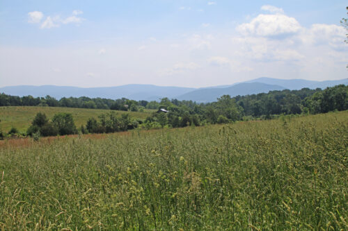
 Virginia is fortunate to have abundant forestland that sustains the Commonwealth’s economy, rural communities, and overall environmental health. From the mountains to the Bay, intact managed forests provide substantial benefits to Virginia’s people and natural communities.
Unfortunately, rapid population growth and expansion put these forests and their benefits at risk. Each year, significant portions of Virginia’s forests are converted to other uses, primarily for development. Conversion of forest acres, as well as the fragmentation of the remaining acres, reduces the potential of the forestland base to provide economic, social, and ecological benefits.
The Virginia Department of Forestry (VDOF) is committed to slowing the loss of valuable forestland to non-forest land uses. Because forest conversion results from the choices of individual landowners, VDOF works with landowners to help them keep their land in forest.
Landowner Options for Forestland Conservation
Across the Commonwealth exists a mosaic of family forest and farmland. Forestland conservation is a landscape-scale effort achieved through the cooperation of the individual landowners that steward the majority of Virginia’s forested properties. Your forest can be a critical part of conserving Virginia’s beautiful, valuable forestland, but each family or landowner has unique circumstances and visions for their land. You can find a path to forest conservation that works for you. Conservation doesn’t happen by chance – it takes planning to protect forests in perpetuity. VDOF and our partners offer resources to help landowners take the first steps toward making long-term plans for their properties.
Read more…
- Legacy and estate planning
- Generation Next program to assist landowners with legacy planning
- Conservation easements as a tool for conservation
- Protecting forestland with the Forest Legacy Program
- Century Forest Recognition Program
Get started, contact your local VDOF forester for guidance.
Additional Resources
Learn more about legacy planning for forest landowners.
Learn more about Virginia’s state forests and how VDOF manages state forests to provide conservation benefits.
[posts_table columns="image,title:Title,cf:id_number:ID,content:Description,tax:Media,button" post_type="document-library" rows_per_page="5" exclude_term="Audiences:no, Media:news-releases" term="document-tags:conservation" filters="tax:document-category:Select Category,tax:Media:Select Content Type" search_box="true" reset_button="true"]GIS Data Resources
VDOF has made available various GIS data sets – one specifically related to forestland conservation (GIS software required.) The Forest Conservation Value (FCV) is a modeled raster layer (geo tiff format) that identifies high-value conservation forests across Virginia. The current version of the model was produced in 2020. It is meant as a tool to help drive strategic, informed, and targeted decisions about where to focus forest conservation efforts. The model is based on a weighted combination of six component layers (e.g., forest management potential, threat of conversion). A detailed description of the methods used to produce the layer is included in the materials for download.
Contact Us
If you’re unsure where to start, contact your local VDOF forester for guidance.
For more information or questions, e-mail us or use our contact form.